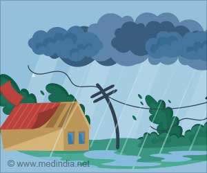
While humans can’t prevent these disasters from occurring, the rapidly increasing number of satellites that orbit the Earth from space offers a greater opportunity to monitor their evolution, said C.K Shum, co-author of the study and a professor at the Byrd Polar Research Center and in earth sciences at The Ohio State University. He said that potentially allowing people in the area to make informed decisions could improve the effectiveness of local disaster response and management.
Shum’s research uses geodesy the science of measuring the planet’s size, shape and orientation in space to study phenomena related to global climate change.
Using geodetic data gathered from various space agency satellites, researchers conducted several case studies to test whether a mix of remote sensing and deep machine learning analytics could accurately monitor abrupt weather episodes, including floods, droughts and storm surges in some areas of the world.
Advertisement
In one experiment, the team used these methods to determine if radar signals from Earth’s Global Navigation Satellite System (GNSS), which were reflected over the ocean and received by GNSS receivers located at towns offshore in the Gulf of Mexico, could be used to track hurricane evolution by measuring rising sea levels after landfall. Between 2020 and 2021, the team studied how seven storms, such as Hurricane Hana and Hurricane Delta, affected coastal sea levels before they made landfall in the Gulf of Mexico. By monitoring these complex changes, they found a positive correlation between higher sea levels and how intense the storm surges were.
The data they used was collected by NASA and the German Aerospace Center’s Gravity Recovery And Climate Experiment (GRACE) mission, and its successor, GRACE Follow-On. Both satellites have been used to monitor changes in Earth’s mass over the past two decades, but so far, have only been able to view the planet from a little more than 400 miles up. But using deep machine learning analytics, Shum’s team was able to reduce this resolution to about 15 miles, effectively improving society’s ability to monitor natural hazards.
“Taking advantage of deep machine learning means having to condition the algorithm to continuously learn from various data inputs to achieve the goal you want to accomplish,” Shum said. In this instance, satellites allowed researchers to quantify the path and evolution of two Category 4 Atlantic hurricane-induced storm surges during their landfalls over Texas and Louisiana, Hurricane Harvey in August 2017 and Hurricane Laura in August 2020, respectively.
But in the short term, Shum would like to see countries and organizations make their satellite data more readily available to scientists, as projects that rely on deep machine learning often need large amounts of wide-ranging data to help make accurate forecasts.
“Many of these novel satellite techniques require time and effort to process massive amounts of accurate data,” said Shum. “If researchers have access to more resources, we’ll be able to potentially develop technologies to better prepare people to adapt, as well as allow disaster management agencies to improve their response to intense and frequent climate-induced natural hazards.”
Source: Eurekalert
Source link
#Deep #Learning #Models #Predicting #Climateinduced #Disasters